Middle Fly District (Middle Fly)
The Middle Fly District of the Western Province of Papua New Guinea is a large, coastal district that forms the central area of the Fly River basin. It contains the Local-Level Government areas of: Balimo Urban, Bamu Rural, Gogodaia Rural, Lake Murray Rural, and Nomad Rural, and the population centres of Balimo, Bamu, Gogodala and Nomad. It also contains the largest lake in the country, Lake Murray.
The population of the district in the 2011 census was 79,349. The most Populous LLG in the area at that time was Gogodala, with almost 25,000 people, making Gogodala the most populous LLG in the province.
The population of the district in the 2011 census was 79,349. The most Populous LLG in the area at that time was Gogodala, with almost 25,000 people, making Gogodala the most populous LLG in the province.
Map - Middle Fly District (Middle Fly)
Map
Country - Papua_New_Guinea
 |
 |
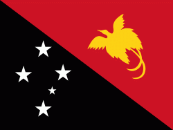
| Flag of Papua New Guinea | |
At the national level, after being ruled by three external powers since 1884, including nearly 60 years of Australian administration starting during World War I, Papua New Guinea established its sovereignty in 1975. It became an independent Commonwealth realm in 1975 with Elizabeth II as its queen. It also became a member of the Commonwealth of Nations in its own right.
Currency / Language
| ISO | Currency | Symbol | Significant figures |
|---|---|---|---|
| PGK | Papua New Guinean kina | K | 2 |
| ISO | Language |
|---|---|
| EN | English language |
| HO | Hiri Motu language |


